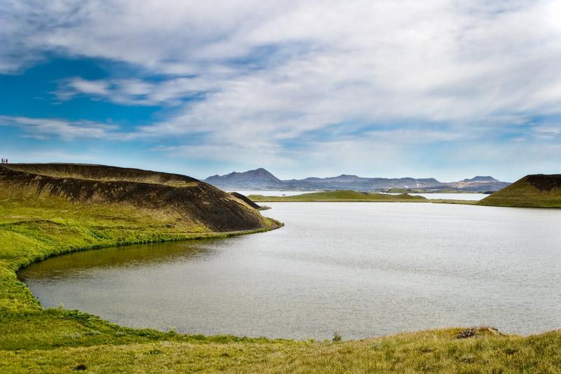
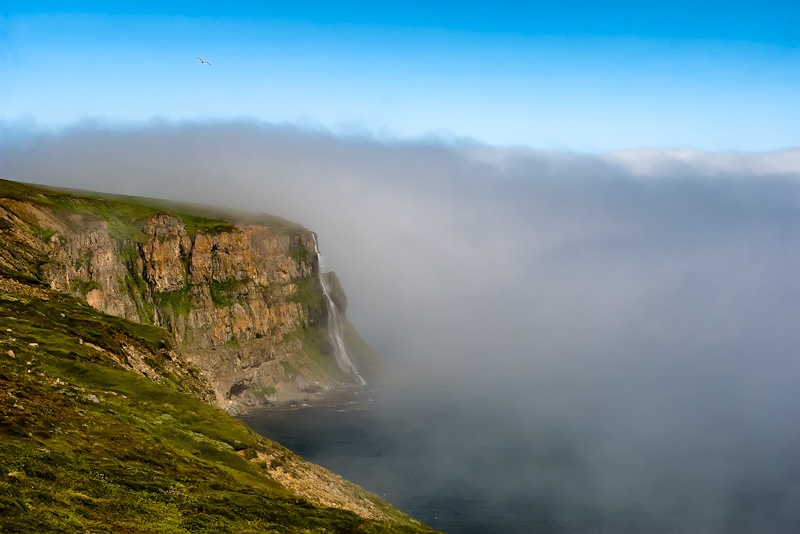
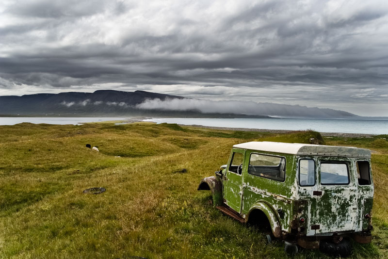
La valle si stendeva fino alle foschie dell’orizzonte orientale e oltre. Una terra quieta, fatta di fertile suolo nero, solcata da vasti, lenti fiumi, punteggiata di mille piccoli laghi che riflettevano la luce del sole come mille specchi.
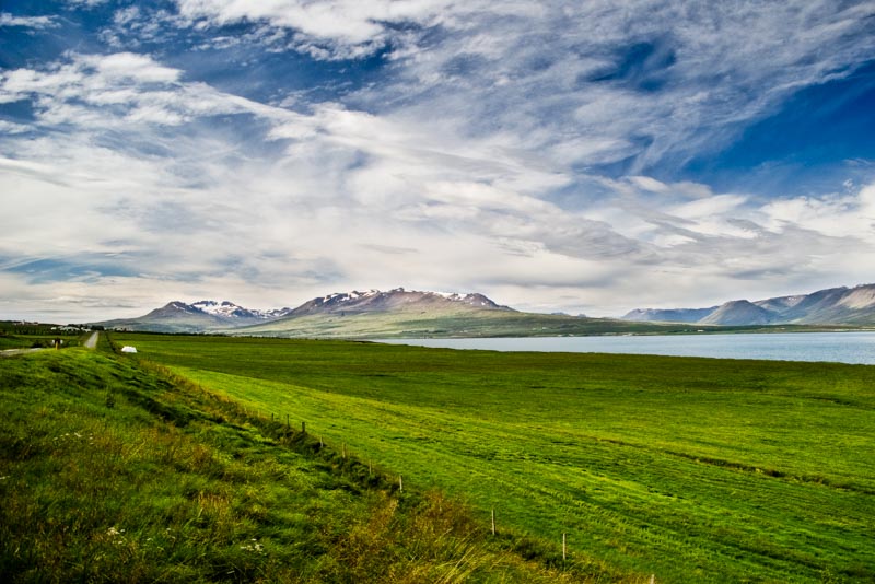
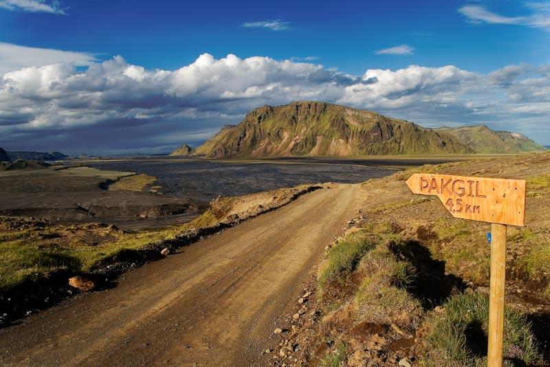
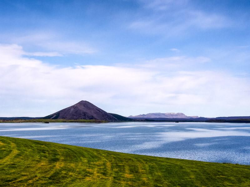
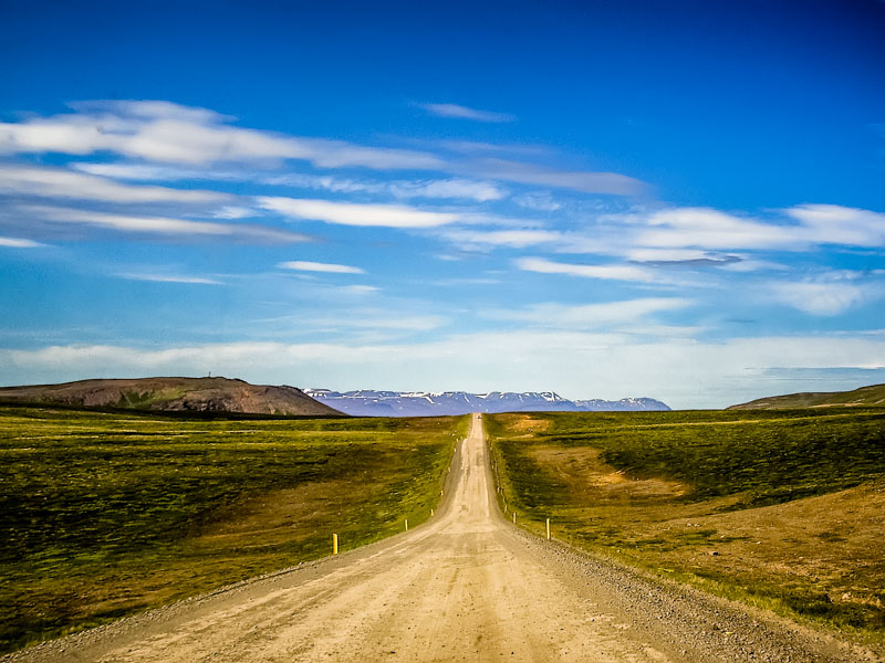
Se Catelyn Stark di Casa Tully fosse stata la nostra guida alla scoperta del centro dell’’ Islanda, avrebbe presentato così l’ interno dell’ isola. Qui non ci sono più né case né uomini ma solo pecore e cavalli. I cellulari non hanno campo e le strade sono sterrati che si affidano alla clemenza del tempo e della lava.
Questo è il regno primigenio della natura, ancora imprevedibile e violenta.
Fjallabak
Al centro dell’ Islanda, la regione di Fjallabak è la seconda più grande area geotermale d’ Islanda ed il suo più grande giacimento di riolite. La riolite è una roccia di origine vulcanica che può assumere aspetti molto diversi a seconda di come viene eruttata e della temperatura della superficie sulla quale si posa. La grigia pietra pomice è riolite e così pure la nera e lucida ossidiana.

Brennisteinsalda
L’ onda multicolore del Brennisteinsalda si alza proprio in questa zona
Brennisteinsalda è un vulcano con un cono quasi perfetto. E’ un ottimo posto per apprezzare il polimorfismo della riolite. Qui c’è tutto il fascino dei colori minerali, che chiazzano un paesaggio altrimenti irrimediabilmente grigio. Il rosso del ferro, il giallo dello zolfo, la lava blu e nera. E come se non bastasse ecco altre aggiunte alla tavolozza. Il verde fosforescente dei muschi, con in fondo l’ azzurro dei laghi ed il bianco dei ghiacciai.

Dopo essere giunti in cima ed ammirato un panorama quasi extraterrestre, torniamo a valle.
Risaliamo un fiume che non ha più un corso fisso.
Nel 1783, durante la catastrofica eruzione del vulcano Laki la valle fu interamente riempita di lava. Da allora il fiume ha perso il suo letto. Precipita dall’ altipiano con una spettacolare cascata, per andare a disperdersi sulla pianura in basso, in una specie di intricato delta interno. Si fa strada tra la sabbia vulcanica e le rocce fino a definirsi in tre rami principali, che procedono quasi paralleli fino alla foce.

Magnus Stephensen nel XIX secolo fu avvocato e giudice in Islanda. Ci ha lasciato una cronaca scarna e precisa di quei fatti:
“L’ 11 giugno occorse un fatto straordinario che stupì molto tutti gli abitanti: il fiume Skafta, un fiume di una certa importanza che nasce dal ghiacciaio Skaftarjökull […] che nell’ inverno e primavera del 1783 aveva un notevole volume d’ acqua ed il cui corso ancora nei giorni 9 e 10 era ancora rapido e agitato, si prosciugò completamente, tanto che la gente potette attraversarne il letto per raggiungere a piedi luoghi che in precedenza potevano essere raggiunti soltanto in barca e con grande difficoltà.
La causa di questo rimarchevole fenomeno fu presto chiara: una terrificante colata di lava che si riversò a valle come un mare spumeggiante lungo la valle del fiume , provenendo da un luogo in mezzo alle montagne. La lava scorreva in un canale profondo fino a venti metri, ma presto lo riempì completamente e tracimò nei terreni circostanti per una vasta estensione su entrambi i lati della valle.”

Eldgjà, la gola di fuoco
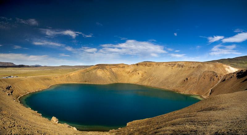
Ancora prima, verso la metà del X secolo, qui la terra si spaccò e dalla fenditura sgorgarono chilometri cubici di lava che si sparsero nel territorio circostante e arrivarono fino al mare. L’ eruzione durò otto anni. Quando terminò lasciò in eredità un oceano di magma che andava solidificandosi, e l’ Eldgjà, il cratere da cui tutto era iniziato. Ma non immaginate un tipico cratere vulcanico. Si tratta piuttosto di un’ immensa spaccatura della crosta terrestre, la più grande fenditura vulcanica del mondo. Lunga 30 chilometri, profonda 150 metri, larga in alcuni tratti fino a 600 metri, fiancheggiata da monti brulli. Un territorio inospitale ed aspro.

Eldgjà significa gola di fuoco, ma il nome non si riferisce tanto a ciò che essa ha eruttato e che nessun essere umano ha mai visto e raccontato. Si riferisce soprattutto al suo colore attuale. Infatti le pareti di questo canyon hanno un colorito rossastro, dovuto ai minerali di ferro contenuti nel magma solidificato.
Ora, a distanza di oltre mille anni dall’ eruzione, la valle è solcata da ruscelli e cascate, ma l’ asprezza del clima e del terreno ancora non hanno permesso la nascita di una vera vegetazione. Solo muschi e licheni e radi spiazzi erbosi nei pressi dei corsi d’ acqua.

Il trekking è faticoso, i piedi affondano nella sabbia vulcanica; qui le colline sono ammassi di lava e le montagne sono vulcani.
E quando si torna finalmente in pianura, contenti per il cammino più agevole, scopriamo l’ inganno: siamo in una vera e propria palude, dal fondo sabbioso e molle e con tanti piccoli corsi d’ acqua da guadare. E’ il fiume che ha perso il suo letto che torna a visitarci.

Bagni termali a Strutslaug
Il percorso si fa incerto, non c’è un sentiero segnato ma solo una direzione da seguire ed un traguardo da raggiungere: le pozze geotermali di Strutslaug.
Le pozze sono alimentate da acqua che sgorga dal suolo, ad una temperatura tale che ci lesserebbe in pochi minuti. Inizia a raffreddarsi mentre scorre verso la prima delle due piscine naturali, che sono poste su livelli leggermente differenti. Quella più in alto è più calda, a temperatura quasi insopportabile (chi vi si immerge ne esce tutto rosso fino al collo) ma più pulita.
La pozza più in basso raccoglie tutte le alghe morte trascinate dalla corrente (le acque sono infatti ricche di sali e minerali e questo favorisce un intenso sviluppo algale), ma la temperatura è leggermente più bassa, intorno ai quaranta gradi, ed è piacevole immergersi.
Stando seduti ci si trova nell’ acqua fino a metà dorso e se si ha freddo basta calarsi un po’ per ritrovarsi completamente avvolti da un piacevole tepore e pensare che in fondo sarebbe bello potersene restare qui per tutto il tempo che resta, magari anche per tutta la notte.

Questi racconti sono tratti dal mio libro che racconta un lungo viaggio estivo verso Nord: Islanda, Groenlandia e Russia. Se vi piacciono, provate a fare click sul bottone qui sotto!


![Jökulsárlón (literally "glacial river lagoon") is a large glacial lagoon in southeast Iceland, on the borders of Vatnajökull National Park. Situated at the head of Breiðamerkurjökull, it evolved into a lagoon after the glacier started receding from the edge of the Atlantic Ocean. The lake has grown since then at varying rates because of melting of the Icelandic glaciers. The lagoon now stands 1.5 kilometres (0.93 mi) away from the ocean's edge and covers an area of about 18 km2 (6.9 sq mi). It recently became the deepest lake in Iceland at over 248 metres (814 ft) depth as glacial retreat extended its boundaries.[1] The size of the lagoon has increased fourfold since the 1970s.[2][3][4][5] It is considered as one of the natural wonders of Iceland. The lagoon can be seen along Route 1 between Höfn and Skaftafell. It presents a picturesque parade termed as “A ghostly procession of luminous blue ice-bergs through the 17 km2 (6.6 sq mi) (18 km2 (6.9 sq mi) as reported in other sources) Jokulsarlon Lagoon”.[3] Jökulsárlón has been a setting for four Hollywood movies -- A View to a Kill, Die Another Day, Tomb Raider and Batman Begins -- in addition to the reality-TV series Amazing Race.[3][6] A postage stamp depicting Jökulsárlón was issued in 1991 with a face value of 26 krónur.[2] The tongue of the Breiðamerkurjökull glacier is a major attraction for tourists. Tour operators conduct snowmobile and jeep tours to visit the glacier along the winding iceberg-studded Jökulsárlón Lagoon. The base station for visits to the area is at Joklasel, which is approached from Hofn. The Jökulsárlón lagoon provides outstanding views of the Ice Cap, which is a vast dome of ice that rises to a height of 3,000 feet (910 m). It spills to the lagoon 12 miles (19 km) away from the jagged glacier hill to the edge of the water line. The lagoon developed only about 60 years ago (1948 is mentioned), when the entire area was less than 100 feet (30 m) of glacier, which was only 250 yards (230 m) from the Atlantic Ocean, and 2 miles (3.2 km) away from Vatnajökull . Vatnajökull was at the shore line of the ocean and dropped icebergs into the ocean. However, it started drifting in land rapidly every year leaving deep gorges en route, which got filled with melted water and large chunks of ice. These icebergs gather at the mouth of the lagoon’s shallow exit, melt down into smaller ice cubes and roll out into the sea. The lagoon is the lowest point in Iceland with land at 200 metres (660 ft) below sea level. In summer, they melt and roll down the channel into the sea. In winter the lagoon freezes and locks the icebergs in place. Ice water and soil make a unique ecological phenomenon. Jökulsárlón lake or lagoon, the Icelandic “glacier lake” is now reported to have doubled in size in the recent 15-year period. The huge blocks of ice that calve from the edge of Vatnajökull are about 30 metres (98 ft) high which fills the lagoon stocked with icebergs.[5][7][8][9] Some icebergs appear naturally sculpted on account volcanic ashes from ancient eruptions that partly cover them.[10] An iceberg with Vatnajökull in the background. The icebergs in Jökulsárlón, as well as this iceberg, are icebergs that fell off Vatnajökull. An isolated iceberg on the sand beach Glacial lagoon with icebergs With the rate at which Vatnajökull is retreating and the lagoon is getting formed, in the near future, it is anticipated that there is likely to be a deep fjord where Vatnajökull is now. This retreat is also posing a threat to the National Highway Route 1 of Iceland. Reykjavík, the capital of Iceland is 250 kilometres (160 mi) from the lake and the road between the capital and the lagoon winds through a dozen other glaciers, which are also under retreat. It is 75 kilometres (47 mi) to the west of Höfn town and 60 kilometres (37 mi) east of Skaftafell National Park.[8][10] It is accessible by the ring road, Route 1, that goes across the lagoon, and where parking facilities have been provided for visitors. It is also known as the "Tourist Conveyor belt". While walking on the shore, isolated large blocks of icebergs can be seen on the black sand beach.[5] The picturesque scene of the Jökulsárlón lagoon and the Breiðamerkurjökull glacier have been part of the James Bond films A View to a Kill (1985) and Die Another Day (2002), as well as Batman Begins (2005)[3] and Beowulf and Grendel (2005). The popularity of the glaciers could be attributed to these blockbuster films, to Lara Croft's Tomb Raider and also to the popular commercials which have been centred on this location.[4][10] Choreographing the car chase scene, which was once called one of the greatest movie car chases of all time, between a Jaguar and Aston Martin, a set that was created for the film at the location of the lagoon was a challenge to 'Action Unit' Director Vic Armstrong, of the Bond film Die Another Day.[15] The popularity of the lagoon has been further boosted by the TV coverage provided live from Jökulsárlón Lagoon on the American TV program Good Morning America (American morning news and talk show that is broadcast on the ABC television network) in southeast Iceland, on November 13, 2006. The "amazing landscape” covered on the TV programme not only included Jökulsárlón Lagoon filled with icebergs but also pictures of Antarctica and the polar ice caps, which were telecast live from Iceland. This live broadcast, which was made possible by a crew of 30 people, is reported to have been watched by 4 million people. Jökulsárlón è il più grande e più conosciuto lago di origine glaciale dell'Islanda. Situato a sud del ghiacciaio Vatnajökull, tra il Parco nazionale Skaftafell e la città di Höfn, apparve per la prima volta tra il 1934 e il 1935 e dal 1975 crebbe dai 7,9 km² agli attuali 18 km² di superficie, a causa dello scioglimento accelerato dei ghiacciai islandesi. Possiede una profondità massima di circa 200 m, il che lo rende probabilmente il secondo lago più profondo d'Islanda. Una delle sue caratteristiche più sorprendenti è la presenza di numerosi iceberg che derivano dalla lingua del ghiacciaio del Breiðamerkurjökull.](https://www.photosontheroad.eu/wp-content/uploads/2022/03/17072008-IMGP4489.jpg "Jökulsárlón (literally \"glacial river lagoon\") is a large glacial lagoon in southeast Iceland, on the borders of Vatnajökull National Park. Situated at the head of Breiðamerkurjökull, it evolved into a lagoon after the glacier started receding from the edge of the Atlantic Ocean. The lake has grown since then at varying rates because of melting of the Icelandic glaciers. The lagoon now stands 1.5 kilometres (0.93 mi) away from the ocean's edge and covers an area of about 18 km2 (6.9 sq mi). It recently became the deepest lake in Iceland at over 248 metres (814 ft) depth as glacial retreat extended its boundaries.[1] The size of the lagoon has increased fourfold since the 1970s.[2][3][4][5] It is considered as one of the natural wonders of Iceland. The lagoon can be seen along Route 1 between Höfn and Skaftafell. It presents a picturesque parade termed as “A ghostly procession of luminous blue ice-bergs through the 17 km2 (6.6 sq mi) (18 km2 (6.9 sq mi) as reported in other sources) Jokulsarlon Lagoon”.[3] Jökulsárlón has been a setting for four Hollywood movies -- A View to a Kill, Die Another Day, Tomb Raider and Batman Begins -- in addition to the reality-TV series Amazing Race.[3][6] A postage stamp depicting Jökulsárlón was issued in 1991 with a face value of 26 krónur.[2] The tongue of the Breiðamerkurjökull glacier is a major attraction for tourists. Tour operators conduct snowmobile and jeep tours to visit the glacier along the winding iceberg-studded Jökulsárlón Lagoon. The base station for visits to the area is at Joklasel, which is approached from Hofn. The Jökulsárlón lagoon provides outstanding views of the Ice Cap, which is a vast dome of ice that rises to a height of 3,000 feet (910 m). It spills to the lagoon 12 miles (19 km) away from the jagged glacier hill to the edge of the water line. The lagoon developed only about 60 years ago (1948 is mentioned), when the entire area was less than 100 feet (30 m) of glacier, which was only 250 yards (230 m) from the Atlantic Ocean, and 2 miles (3.2 km) away from Vatnajökull . Vatnajökull was at the shore line of the ocean and dropped icebergs into the ocean. However, it started drifting in land rapidly every year leaving deep gorges en route, which got filled with melted water and large chunks of ice. These icebergs gather at the mouth of the lagoon’s shallow exit, melt down into smaller ice cubes and roll out into the sea. The lagoon is the lowest point in Iceland with land at 200 metres (660 ft) below sea level. In summer, they melt and roll down the channel into the sea. In winter the lagoon freezes and locks the icebergs in place. Ice water and soil make a unique ecological phenomenon. Jökulsárlón lake or lagoon, the Icelandic “glacier lake” is now reported to have doubled in size in the recent 15-year period. The huge blocks of ice that calve from the edge of Vatnajökull are about 30 metres (98 ft) high which fills the lagoon stocked with icebergs.[5][7][8][9] Some icebergs appear naturally sculpted on account volcanic ashes from ancient eruptions that partly cover them.[10] An iceberg with Vatnajökull in the background. The icebergs in Jökulsárlón, as well as this iceberg, are icebergs that fell off Vatnajökull. An isolated iceberg on the sand beach Glacial lagoon with icebergs With the rate at which Vatnajökull is retreating and the lagoon is getting formed, in the near future, it is anticipated that there is likely to be a deep fjord where Vatnajökull is now. This retreat is also posing a threat to the National Highway Route 1 of Iceland. Reykjavík, the capital of Iceland is 250 kilometres (160 mi) from the lake and the road between the capital and the lagoon winds through a dozen other glaciers, which are also under retreat. It is 75 kilometres (47 mi) to the west of Höfn town and 60 kilometres (37 mi) east of Skaftafell National Park.[8][10] It is accessible by the ring road, Route 1, that goes across the lagoon, and where parking facilities have been provided for visitors. It is also known as the \"Tourist Conveyor belt\". While walking on the shore, isolated large blocks of icebergs can be seen on the black sand beach.[5] The picturesque scene of the Jökulsárlón lagoon and the Breiðamerkurjökull glacier have been part of the James Bond films A View to a Kill (1985) and Die Another Day (2002), as well as Batman Begins (2005)[3] and Beowulf and Grendel (2005). The popularity of the glaciers could be attributed to these blockbuster films, to Lara Croft's Tomb Raider and also to the popular commercials which have been centred on this location.[4][10] Choreographing the car chase scene, which was once called one of the greatest movie car chases of all time, between a Jaguar and Aston Martin, a set that was created for the film at the location of the lagoon was a challenge to 'Action Unit' Director Vic Armstrong, of the Bond film Die Another Day.[15] The popularity of the lagoon has been further boosted by the TV coverage provided live from Jökulsárlón Lagoon on the American TV program Good Morning America (American morning news and talk show that is broadcast on the ABC television network) in southeast Iceland, on November 13, 2006. The \"amazing landscape” covered on the TV programme not only included Jökulsárlón Lagoon filled with icebergs but also pictures of Antarctica and the polar ice caps, which were telecast live from Iceland. This live broadcast, which was made possible by a crew of 30 people, is reported to have been watched by 4 million people. Jökulsárlón è il più grande e più conosciuto lago di origine glaciale dell'Islanda. Situato a sud del ghiacciaio Vatnajökull, tra il Parco nazionale Skaftafell e la città di Höfn, apparve per la prima volta tra il 1934 e il 1935 e dal 1975 crebbe dai 7,9 km² agli attuali 18 km² di superficie, a causa dello scioglimento accelerato dei ghiacciai islandesi. Possiede una profondità massima di circa 200 m, il che lo rende probabilmente il secondo lago più profondo d'Islanda. Una delle sue caratteristiche più sorprendenti è la presenza di numerosi iceberg che derivano dalla lingua del ghiacciaio del Breiðamerkurjökull.")