


A ovest della Norvegia si trova un’isola chiamata Islanda, circondata dal vasto Oceano. È questo un luogo difficile da abitare, ma che merita di essere menzionato per il verificarsi di fatti prodigiosi e inauditi, che sembrano sfuggire a ogni verosimiglianza.

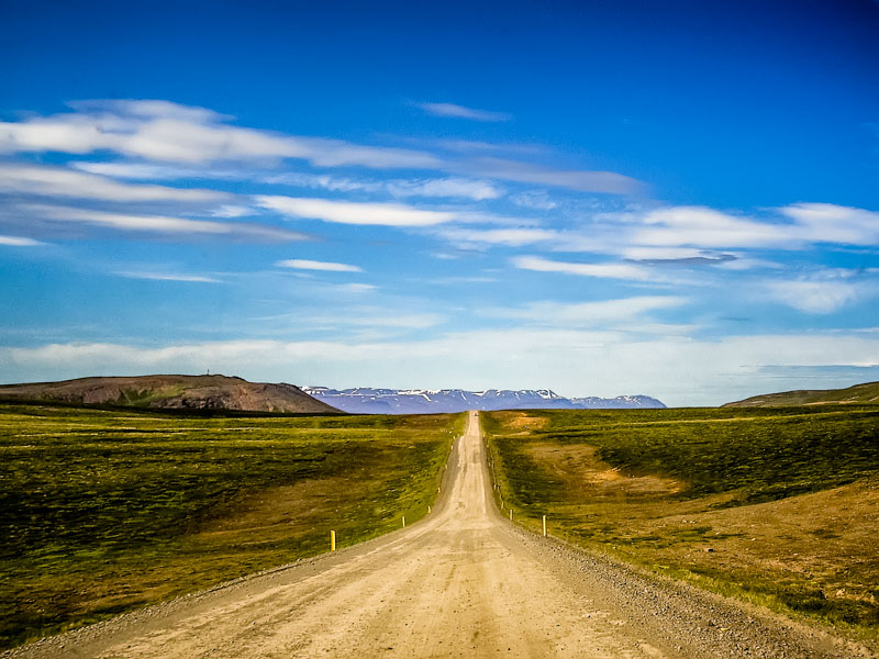
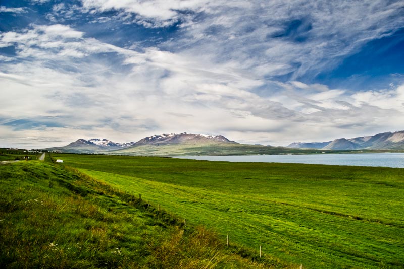
La strada da Akureyri punta verso Nord lungo la sponda occidentale dell’ Eyjafjördur. Sessanta chilometri dal fondo allo sbocco al mare, circondati da montagne innevate che sfiorano i mille metri.
E mille metri, a queste latitudini sono un’ enormità, ben oltre il limite delle nevi perenni.
Sopra i quattrocento metri di altitudine in Islanda non vive nessuno, non ci sono pascoli. Solo rocce e ghiaccio.

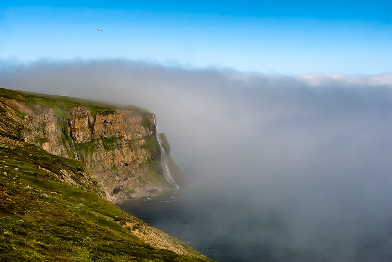
La nebbia va e viene, ma quando va via scopre panorami mozzafiato, a strapiombo sul mare. Dietro una curva la sorpresa di una cascata che precipita per centinaia di metri fino a raggiungere direttamente le acque del fiordo. Il tonfo sulla superficie del mare deve essere più fragoroso del rumore delle alte onde dell’ oceano che battono in continuazione questa altissima falesia.
Dalvik. Poche case, niente traffico ed un segnale di pericolo per attraversamento anatre.

Poi la strada inizia a salire verso il passo di Öxnadalsheidi a 540 metri di altezza.
Entriamo nel Tröllaskagi con cielo macchiato di nuvole in transito veloce ed un panorama splendido. Il blu cobalto del fiordo da un lato, il verde ed ocra, poi bianco delle montagne dall’ altro.
Pendii alti e scoscesi ma che non sembrano intransitabili.
Sono ingannatrici queste montagne. Non ci sono picchi rocciosi ad intimidirti, il deserto minerale di altipiani desolati.
Senza alberi, tutto è in vista e ogni sentiero sembra facilmente percorribile. Ma è un inganno, agevolato dalla luce del sole che quando c’è ingentilisce tutto. Non vorrei essere qui da solo in una notte d’ inverno.

Prima di arrivare a Siglufjördur, un buco nero: un tunnel di quattro chilometri, ma che tunnel strano! Sembra di entrare in una miniera. La galleria non è rivestita di cemento, è nuda roccia lavica, nera. All’ interno l’ illuminazione è scarsa. La carreggiata è unica ed è anche stretta! C’è a malapena lo spazio per far transitare un camion. Ogni cento metri, e solo da un lato, c’è una piazzola, lunga quanto basta per farci entrare due automobili.
In questi tunnel in Islanda il diritto di precedenza è regolato dalla presenza della piazzola di sosta. Chi ce l’ ha dal suo lato di marcia deve lasciar passare gli altri velivoli.
Ma i problemi sorgono quando ad incontrarsi sono due camion!
L’ autotreno che non ha diritto di precedenza deve fare retromarcia, al buio, con la carreggiata stretta e magari con altre auto o altri TIR dietro di sé. Retromarcia fino all’ imbocco della galleria se è troppo ingombrante per sostare nella piazzola!
E se il tunnel è lungo cinque chilometri e l’ incontro avviene giusto a metà strada, la faccenda si fa lunga e complicata.

Finalmente raggiungiamo Siglufjördur. Grazie all’ industria della pesca e lavorazione delle aringhe, questo villaggio è stato il Klondyke degli Islandesi nella prima metà del XX secolo .
Tutto iniziò nel 1903, con l’ arrivo dei Norvegesi. Erano alla ricerca di pesce con nuove tecniche: le reti a circuizione, che possono rinchiudersi velocemente attorno ad un’ intero banco di aringhe. I risultati di quest’ innovazione tecnologica si rivelarono eccellenti.
Allo sviluppo della pesca seguì quello di Siglufjördur. Il villaggio divenne l’ incontrastato centro dell’ industria della pesca fino ad arrivare a contare – nel periodo di massima prosperità – ventitre stazioni di salatura e cinque industrie di lavorazione.

Si instaurò così un’ atmosfera simile a quella della corsa all’ oro. Tanto che Siglufjördur venne soprannominata appunto “Klondyke islandese” e divenne la base operativa di centinaia di pescherecci destinati alla pesca delle aringhe. C’ era ormeggio per tutti nelle protette acque del fiordo quando infuriava il cattivo tempo.
A terra erano centinaia le persone che lavoravano, senza contare i pescatori. Un numero enorme in relazione alla popolazione islandese. Ma bisogna fare i conti con la povertà di quel tempo. Il villaggio iniziò ad attrarre anche speculatori, che si arricchivano o perdevano tutto con inquietante frequenza.
Siglufjördur divenne così fucina di nuovi equilibri sociali. Quelle migliaia di Islandesi che fecero fortuna con le aringhe erano dei disperati, appartenenti ai settori più poveri della popolazione. Solo a causa della povertà e della fame avevano accettato di lasciare i propri luoghi natali e trasferirsi al Nord, nella parte più fredda ed inospitale della fredda ed inospitale Islanda.
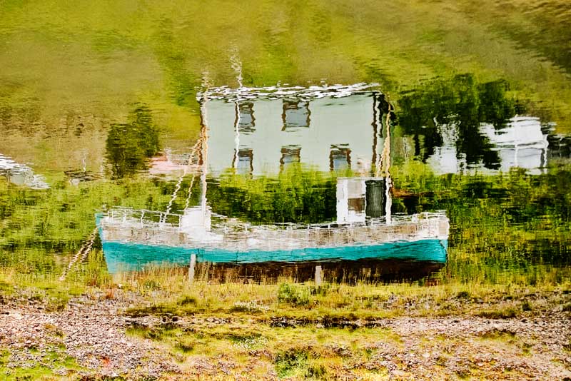
E fu grazie alle aringhe che in capo a pochi anni costoro si ritrovarono agiati o benestanti o addirittura ricchi. Uno sconvolgimento dei precedenti equilibri sociali ed economici che darà la spinta alla modernizzazione della società e dell’ economia di quest’ isola, al tempo ancora ancorate a modelli quasi di sopravvivenza, basati sulla pesca e su attività agricole e pastorizie. Tutte troppo intimamente connesse alle imprevedibilità del clima artico.
Questo fervore durò una trentina d’ anni.
La fine dell’ epopea fu segnata – paradossalmente – dall’ introduzione della scoperta scientifica che permise un ulteriore aumento del pescato e quindi della ricchezza prodotta. Il sonar permetteva di localizzare in anticipo i grossi banchi di aringhe così che le imbarcazioni potessero dirigersi esattamente nel punto migliore per la cattura.
Ma le risorse della Natura non sono illimitate. Il supersfruttamento fece diminuire di numero e di volume i banchi di aringhe, finché, nel 1969, queste sparirono.

Da allora Siglufjördur non si è mai più ripresa. Oggi dei moli superaffollati di cinquant’ anni fa non resta che qualche moncone arrugginito, con pochi pescherecci attraccati. Per la strada la gente è poca.
I collegamenti sono assicurati dalla strada tortuosa che abbiamo appena percorso e da una striscia di asfalto che funge da aeroporto, ma non ci sono collegamenti di linea. Le industrie di lavorazione sono state chiuse e smantellate.
In una delle più vecchie, Róaldsbrakki, realizzata in puro stile norvegese – con il legno dipinto di rosso e le finestre bianche – è stato installato un interessante museo dedicato alla memoria di quei tempi “eroici”.

All’ interno ci sono le linee di produzione di un tempo, antichi pescherecci dell’ inizio del ventesimo secolo, abiti ed attrezzature da lavoro, ed anche esempi di tutto ciò che veniva prodotto con le aringhe, dalle conserve in scatola agli ingredienti per la realizzazione di creme per il corpo.
Fuori c’è un bar aperto, il vento che sbatte sugli alberi delle imbarcazioni ormeggiate e quasi nessuno in giro.

Ti è piaciuto? Ti andrebbe di leggere ancora le mie storie di viaggio e fotografia?
Perché non ti iscrivi alla mia newsletter?
Ne riceverai una solo quando pubblicherò un nuovo articolo ed i tuoi dati non verranno mai comunicati a terzi!
Se invece vuoi continuare a goderti belle foto di viaggio, usa il menu in alto e fai un giro per il mio sito!
Sapevi che puoi spedire gratis tutte le e-card che vuoi? Scegli le foto che ti piacciono di più e poi clicca sul bottone E-Card in basso a destra per spedirle a chi vuoi. E’ semplice ed è gratis!

![Jökulsárlón (literally "glacial river lagoon") is a large glacial lagoon in southeast Iceland, on the borders of Vatnajökull National Park. Situated at the head of Breiðamerkurjökull, it evolved into a lagoon after the glacier started receding from the edge of the Atlantic Ocean. The lake has grown since then at varying rates because of melting of the Icelandic glaciers. The lagoon now stands 1.5 kilometres (0.93 mi) away from the ocean's edge and covers an area of about 18 km2 (6.9 sq mi). It recently became the deepest lake in Iceland at over 248 metres (814 ft) depth as glacial retreat extended its boundaries.[1] The size of the lagoon has increased fourfold since the 1970s.[2][3][4][5] It is considered as one of the natural wonders of Iceland. The lagoon can be seen along Route 1 between Höfn and Skaftafell. It presents a picturesque parade termed as “A ghostly procession of luminous blue ice-bergs through the 17 km2 (6.6 sq mi) (18 km2 (6.9 sq mi) as reported in other sources) Jokulsarlon Lagoon”.[3] Jökulsárlón has been a setting for four Hollywood movies -- A View to a Kill, Die Another Day, Tomb Raider and Batman Begins -- in addition to the reality-TV series Amazing Race.[3][6] A postage stamp depicting Jökulsárlón was issued in 1991 with a face value of 26 krónur.[2] The tongue of the Breiðamerkurjökull glacier is a major attraction for tourists. Tour operators conduct snowmobile and jeep tours to visit the glacier along the winding iceberg-studded Jökulsárlón Lagoon. The base station for visits to the area is at Joklasel, which is approached from Hofn. The Jökulsárlón lagoon provides outstanding views of the Ice Cap, which is a vast dome of ice that rises to a height of 3,000 feet (910 m). It spills to the lagoon 12 miles (19 km) away from the jagged glacier hill to the edge of the water line. The lagoon developed only about 60 years ago (1948 is mentioned), when the entire area was less than 100 feet (30 m) of glacier, which was only 250 yards (230 m) from the Atlantic Ocean, and 2 miles (3.2 km) away from Vatnajökull . Vatnajökull was at the shore line of the ocean and dropped icebergs into the ocean. However, it started drifting in land rapidly every year leaving deep gorges en route, which got filled with melted water and large chunks of ice. These icebergs gather at the mouth of the lagoon’s shallow exit, melt down into smaller ice cubes and roll out into the sea. The lagoon is the lowest point in Iceland with land at 200 metres (660 ft) below sea level. In summer, they melt and roll down the channel into the sea. In winter the lagoon freezes and locks the icebergs in place. Ice water and soil make a unique ecological phenomenon. Jökulsárlón lake or lagoon, the Icelandic “glacier lake” is now reported to have doubled in size in the recent 15-year period. The huge blocks of ice that calve from the edge of Vatnajökull are about 30 metres (98 ft) high which fills the lagoon stocked with icebergs.[5][7][8][9] Some icebergs appear naturally sculpted on account volcanic ashes from ancient eruptions that partly cover them.[10] An iceberg with Vatnajökull in the background. The icebergs in Jökulsárlón, as well as this iceberg, are icebergs that fell off Vatnajökull. An isolated iceberg on the sand beach Glacial lagoon with icebergs With the rate at which Vatnajökull is retreating and the lagoon is getting formed, in the near future, it is anticipated that there is likely to be a deep fjord where Vatnajökull is now. This retreat is also posing a threat to the National Highway Route 1 of Iceland. Reykjavík, the capital of Iceland is 250 kilometres (160 mi) from the lake and the road between the capital and the lagoon winds through a dozen other glaciers, which are also under retreat. It is 75 kilometres (47 mi) to the west of Höfn town and 60 kilometres (37 mi) east of Skaftafell National Park.[8][10] It is accessible by the ring road, Route 1, that goes across the lagoon, and where parking facilities have been provided for visitors. It is also known as the "Tourist Conveyor belt". While walking on the shore, isolated large blocks of icebergs can be seen on the black sand beach.[5] The picturesque scene of the Jökulsárlón lagoon and the Breiðamerkurjökull glacier have been part of the James Bond films A View to a Kill (1985) and Die Another Day (2002), as well as Batman Begins (2005)[3] and Beowulf and Grendel (2005). The popularity of the glaciers could be attributed to these blockbuster films, to Lara Croft's Tomb Raider and also to the popular commercials which have been centred on this location.[4][10] Choreographing the car chase scene, which was once called one of the greatest movie car chases of all time, between a Jaguar and Aston Martin, a set that was created for the film at the location of the lagoon was a challenge to 'Action Unit' Director Vic Armstrong, of the Bond film Die Another Day.[15] The popularity of the lagoon has been further boosted by the TV coverage provided live from Jökulsárlón Lagoon on the American TV program Good Morning America (American morning news and talk show that is broadcast on the ABC television network) in southeast Iceland, on November 13, 2006. The "amazing landscape” covered on the TV programme not only included Jökulsárlón Lagoon filled with icebergs but also pictures of Antarctica and the polar ice caps, which were telecast live from Iceland. This live broadcast, which was made possible by a crew of 30 people, is reported to have been watched by 4 million people. Jökulsárlón è il più grande e più conosciuto lago di origine glaciale dell'Islanda. Situato a sud del ghiacciaio Vatnajökull, tra il Parco nazionale Skaftafell e la città di Höfn, apparve per la prima volta tra il 1934 e il 1935 e dal 1975 crebbe dai 7,9 km² agli attuali 18 km² di superficie, a causa dello scioglimento accelerato dei ghiacciai islandesi. Possiede una profondità massima di circa 200 m, il che lo rende probabilmente il secondo lago più profondo d'Islanda. Una delle sue caratteristiche più sorprendenti è la presenza di numerosi iceberg che derivano dalla lingua del ghiacciaio del Breiðamerkurjökull.](https://www.photosontheroad.eu/wp-content/uploads/2022/03/17072008-IMGP4489.jpg "Jökulsárlón (literally \"glacial river lagoon\") is a large glacial lagoon in southeast Iceland, on the borders of Vatnajökull National Park. Situated at the head of Breiðamerkurjökull, it evolved into a lagoon after the glacier started receding from the edge of the Atlantic Ocean. The lake has grown since then at varying rates because of melting of the Icelandic glaciers. The lagoon now stands 1.5 kilometres (0.93 mi) away from the ocean's edge and covers an area of about 18 km2 (6.9 sq mi). It recently became the deepest lake in Iceland at over 248 metres (814 ft) depth as glacial retreat extended its boundaries.[1] The size of the lagoon has increased fourfold since the 1970s.[2][3][4][5] It is considered as one of the natural wonders of Iceland. The lagoon can be seen along Route 1 between Höfn and Skaftafell. It presents a picturesque parade termed as “A ghostly procession of luminous blue ice-bergs through the 17 km2 (6.6 sq mi) (18 km2 (6.9 sq mi) as reported in other sources) Jokulsarlon Lagoon”.[3] Jökulsárlón has been a setting for four Hollywood movies -- A View to a Kill, Die Another Day, Tomb Raider and Batman Begins -- in addition to the reality-TV series Amazing Race.[3][6] A postage stamp depicting Jökulsárlón was issued in 1991 with a face value of 26 krónur.[2] The tongue of the Breiðamerkurjökull glacier is a major attraction for tourists. Tour operators conduct snowmobile and jeep tours to visit the glacier along the winding iceberg-studded Jökulsárlón Lagoon. The base station for visits to the area is at Joklasel, which is approached from Hofn. The Jökulsárlón lagoon provides outstanding views of the Ice Cap, which is a vast dome of ice that rises to a height of 3,000 feet (910 m). It spills to the lagoon 12 miles (19 km) away from the jagged glacier hill to the edge of the water line. The lagoon developed only about 60 years ago (1948 is mentioned), when the entire area was less than 100 feet (30 m) of glacier, which was only 250 yards (230 m) from the Atlantic Ocean, and 2 miles (3.2 km) away from Vatnajökull . Vatnajökull was at the shore line of the ocean and dropped icebergs into the ocean. However, it started drifting in land rapidly every year leaving deep gorges en route, which got filled with melted water and large chunks of ice. These icebergs gather at the mouth of the lagoon’s shallow exit, melt down into smaller ice cubes and roll out into the sea. The lagoon is the lowest point in Iceland with land at 200 metres (660 ft) below sea level. In summer, they melt and roll down the channel into the sea. In winter the lagoon freezes and locks the icebergs in place. Ice water and soil make a unique ecological phenomenon. Jökulsárlón lake or lagoon, the Icelandic “glacier lake” is now reported to have doubled in size in the recent 15-year period. The huge blocks of ice that calve from the edge of Vatnajökull are about 30 metres (98 ft) high which fills the lagoon stocked with icebergs.[5][7][8][9] Some icebergs appear naturally sculpted on account volcanic ashes from ancient eruptions that partly cover them.[10] An iceberg with Vatnajökull in the background. The icebergs in Jökulsárlón, as well as this iceberg, are icebergs that fell off Vatnajökull. An isolated iceberg on the sand beach Glacial lagoon with icebergs With the rate at which Vatnajökull is retreating and the lagoon is getting formed, in the near future, it is anticipated that there is likely to be a deep fjord where Vatnajökull is now. This retreat is also posing a threat to the National Highway Route 1 of Iceland. Reykjavík, the capital of Iceland is 250 kilometres (160 mi) from the lake and the road between the capital and the lagoon winds through a dozen other glaciers, which are also under retreat. It is 75 kilometres (47 mi) to the west of Höfn town and 60 kilometres (37 mi) east of Skaftafell National Park.[8][10] It is accessible by the ring road, Route 1, that goes across the lagoon, and where parking facilities have been provided for visitors. It is also known as the \"Tourist Conveyor belt\". While walking on the shore, isolated large blocks of icebergs can be seen on the black sand beach.[5] The picturesque scene of the Jökulsárlón lagoon and the Breiðamerkurjökull glacier have been part of the James Bond films A View to a Kill (1985) and Die Another Day (2002), as well as Batman Begins (2005)[3] and Beowulf and Grendel (2005). The popularity of the glaciers could be attributed to these blockbuster films, to Lara Croft's Tomb Raider and also to the popular commercials which have been centred on this location.[4][10] Choreographing the car chase scene, which was once called one of the greatest movie car chases of all time, between a Jaguar and Aston Martin, a set that was created for the film at the location of the lagoon was a challenge to 'Action Unit' Director Vic Armstrong, of the Bond film Die Another Day.[15] The popularity of the lagoon has been further boosted by the TV coverage provided live from Jökulsárlón Lagoon on the American TV program Good Morning America (American morning news and talk show that is broadcast on the ABC television network) in southeast Iceland, on November 13, 2006. The \"amazing landscape” covered on the TV programme not only included Jökulsárlón Lagoon filled with icebergs but also pictures of Antarctica and the polar ice caps, which were telecast live from Iceland. This live broadcast, which was made possible by a crew of 30 people, is reported to have been watched by 4 million people. Jökulsárlón è il più grande e più conosciuto lago di origine glaciale dell'Islanda. Situato a sud del ghiacciaio Vatnajökull, tra il Parco nazionale Skaftafell e la città di Höfn, apparve per la prima volta tra il 1934 e il 1935 e dal 1975 crebbe dai 7,9 km² agli attuali 18 km² di superficie, a causa dello scioglimento accelerato dei ghiacciai islandesi. Possiede una profondità massima di circa 200 m, il che lo rende probabilmente il secondo lago più profondo d'Islanda. Una delle sue caratteristiche più sorprendenti è la presenza di numerosi iceberg che derivano dalla lingua del ghiacciaio del Breiðamerkurjökull.")





1 thought on “Siglufjördur, il Klondyke islandese”