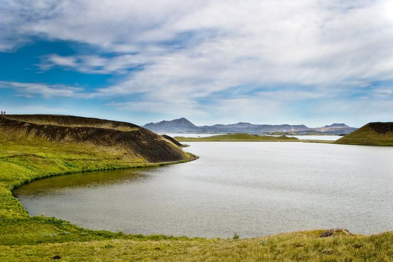
La penisola di Snæfellsnes , a Nord di Reykjavik, è dominata dal profilo del vulcano Snaefells e del suo ghiacciaio.
E’ proprio qui, da questo cratere, che Jules Verne fece iniziare la sua avventura del “Viaggio al Centro della Terra”.
Nel cratere Yökull dello Snæffels che l’ ombra dello Scartaris tocca alle calende di luglio, scendi, coraggioso viaggiatore, e raggiungerai il centro della terra.
(Jules Verne, Viaggio al centro della terra)
Le calende di luglio sono passate da un po’, ma se davvero fossimo stati alla ricerca del cratere giusto per ripetere l’ epopea del professore Otto Lidenbrock e di suo nipote, non ci sarebbe stata alcuna ombra a guidarci. Per tutta la giornata il vulcano è rimasto nascosto dietro una coltre di nubi e di nebbia. Insomma, lo abbiamo visto meglio dalla lontana Reykjavik, stagliarsi contro un cielo azzurro e privo di nuvole. Guardando verso Nord-Ovest il vulcano era lì, con il suo ghiacciaio, tutto bianco ed azzurrino, perfettamente visibile nonostante i centoventi chilometri di distanza.
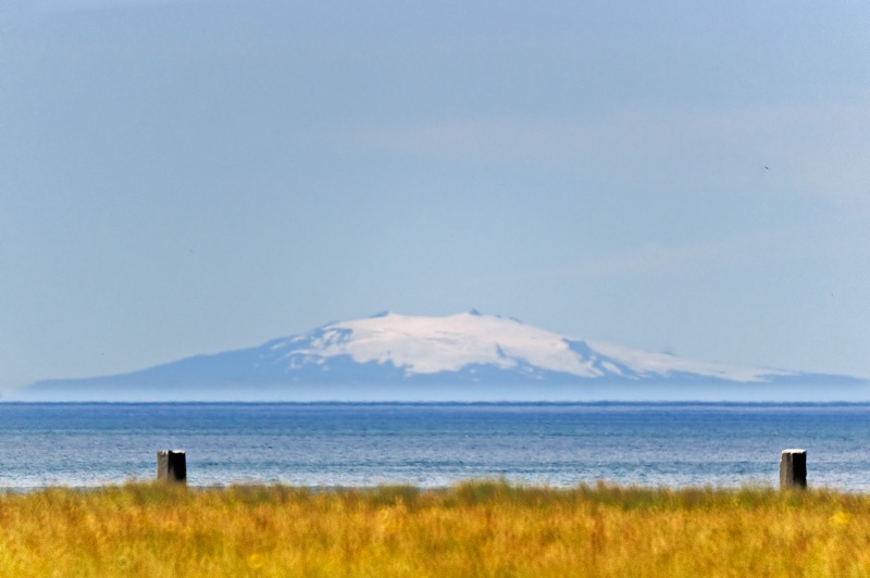
“Un alto monte con due punte, un doppio cono coperto di nevi eterne. […] Lo Snaefells è alto cinquemila piedi, termina con il suo doppio cono, un ammasso di trachite che si stacca dal sistema orografico dell’ isola. Dal nostro punto di partenza si potevano vedere i suoi due picchi profilarsi sul fondo grigiastro del cielo.”
Snaefellss
Non lo abbiamo visto, il vulcano, ma avremmo dovuto “sentirlo”. Si dice infatti che lo Snaefells sia uno dei punti della terra dove si concentra maggiormente l’ “energia cosmica”. Un’ eterea corrente in grado di ricaricare le batterie di qualsiasi animo stressato dal lavoro e dalla routine quotidiana. Vengono in tanti qui – preferibilmente ricchi e famosi, notoriamente i più soggetti allo stress – solo allo scopo di rigenerarsi. Madonna, ad esempio. Cui però piace anche frequentare i lidi pugliesi. E’ un’ eclettica, la signora.
Ogni anno questi amanti dell’ esoterico si danno appuntamento qui, per trascorrere una notte estiva sulla cima del monte. Tutti insieme al gelo per “sentire” meglio l’ energia. Ma oggi forse le nuvole facevano da schermo perché non abbiamo minimamente beneficiato di questa energia. Anzi, a fine giornata eravamo stanchi, diacci ed anche un po’ raffreddati. O forse questa la corrente rigeneratrice è riservata ai ricchi ed ai famosi…
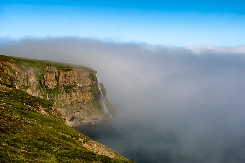
Anche senza riuscire a vedere il vulcano, la penisola è affascinante, per la bellezza della costa e per i fenomeni geotermici. Anche questi sono un regalo dello Snaefells.
Le leggende
E poi ci sono le leggende.
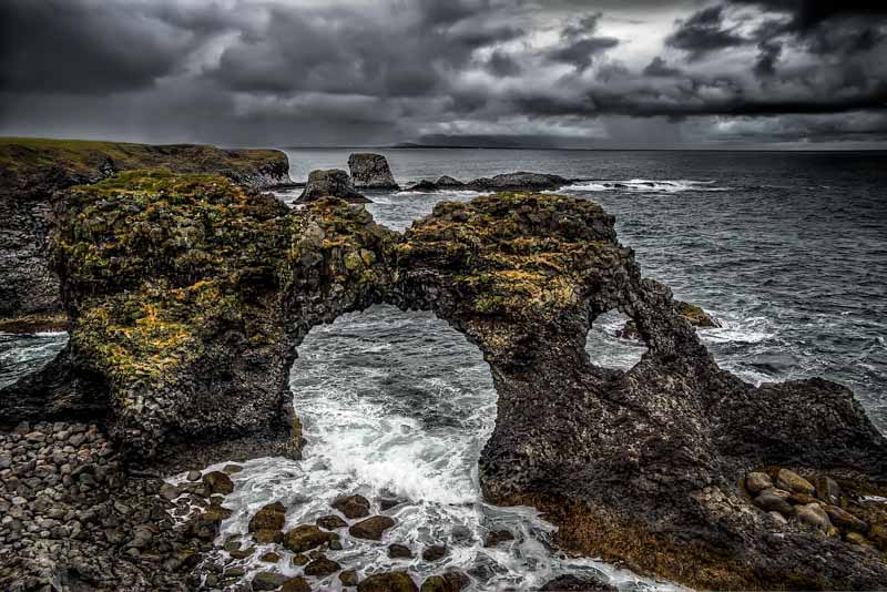
Aggirandosi tra scogliere nere e colline color torba non si può fare a meno di pensare a tutte le saghe che sono state ambientate qui, ed al fatto che da qui, proprio da questa punta, prese il mare – intorno all’ anno 970 – Erik il Rosso.
Erik Il Rosso
Erik era un Vichingo che si era trasferito dalla Norvegia perché era stato dichiarato fuorilegge in patria. Ma poi aveva poi subìto la stessa sorte anche in Islanda. Recidivo, insomma! Dichiarato fuorilegge in tutto il mondo settentrionale conosciuto, aveva solo due possibilità. Poteva cercare di sopravvivere da solo negli inospitali e disabitati altipiani centrali islandesi, ben sapendo che chiunque avrebbe avuto il diritto di ucciderlo. Oppure poteva partire. E così fece. Ma non potendo andare ad Est (era già fuorilegge, là!), la sua rotta si diresse verso Ovest.
“nello stupore generale, decise di mettere la prua a ponente, verso il freddo e brumoso oceano dove dimorava il Serpente che circonda la Terra”
Ma il suo non era un gesto disperato né una follia. Forse un gesto temerario, peraltro in sintonia con l’ indole di Erik. In Islanda tutti sapevano da almeno mezzo secolo, che ad Ovest c’ era terraferma. Un tale Gunnbjörn, che era stato spinto in quella direzione dai venti di una tempesta, aveva avvistato delle immense scogliere prima di riprendere la rotta per l’ Islanda. I suoi discendenti confermavano che tutto era vero.
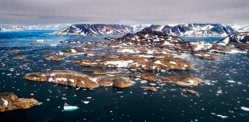
Erik il Rosso raggiunse la Groenlandia, vi si stabilì, e finanche la battezzò con il nome che ancora porta. Ma la sua navigazione continuò. Animo irrequieto, dopo essersi stabilito all’ estremo punta meridionale dell’ isola, un giorno abbandonò il villaggio che aveva fondato. Risalendo la costa occidentale ed attraversando di nuovo il mare sconosciuto, giunse a visitare un’ altra terra: l’ America.
Allora, la scoperta dell’ America sarebbe partita proprio da queste scogliere? Forse, ma tutti sappiamo che la storia assegna a qualcun altro il titolo di scopritore del nuovo continente.
Cristoforo Colombo in Islanda?
Ma anche l’ epopea del navigatore genovese potrebbe avere a che fare con l’ Islanda.
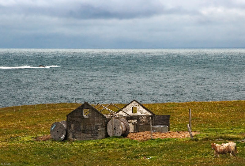
Si dice che Cristoforo Colombo avrebbe svernato in un vecchio porto islandese che si chiama Ingjaldsholl. Non si sa quanto ci sia di vero e quanto sia leggenda, però.
Comunque in Islanda si racconta che nell’ estate del 1477 attraccò in questo porto una nave sulla quale era imbarcato un gentiluomo. Costui sarebbe stato il navigatore genovese, in viaggio di esplorazione. La nave si trattenne ad Ingjaldsholl per quasi un anno. Il gentiluomo interrogò tutti i marinai della zona per conoscere dettagli della navigazione verso Ovest. Forse Colombo proprio qui avrebbe sentito parlare per la prima volta di certi inesplorati territori al di là del mare grigio.
Insomma, in un modo o nell’ altro Snaefellsness ha a che fare con la scoperta dell’ America.
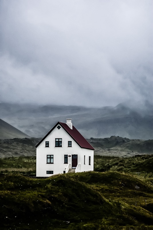
Ingjaldsholl
Di questo misterioso gentiluomo esiste anche un ritratto che lo mostra mentre è in conversazione con il prete della zona. Il quadro è conservato nella chiesa di Ingjaldsholl.
La chiesa – bianca e rossa – si trova proprio in cima al promontorio verdissimo che si getta direttamente nel mare e dove pascolano i cavalli.
La Bárðar Saga Snæfellsáss
Fu ricostruita all’ inizio del ventesimo secolo. Qui un tempo sorgeva una chiesa più grande, (secondo la saga di Viglundar esisteva già nel 1317). E c’ era ed anche una fattoria, di proprietà di Ingjaldur Alfarinsson. Questi – di carattere collerico come tutti i Vichinghi – riuscì a litigare addirittura con la gigantessa Hetta. Costei non era un tipino facile. Se non poteva usare la forza usava l’ inganno. Hetta fece di tutto per sbarazzarsi dell’ oltraggioso Ingjaldur. Una volta cercò anche di farlo morire annegato mentre era a pesca a bordo della sua barca.
Utilizzò le sue arti magiche per trasformare un’ innocua perturbazione in una violentissima tempesta. Il nostro collerico vichingo sarebbe scomparso tra le acque se non fosse accorso in suo aiuto l’ amico Bardar Snaefellsas. Costui era uno strano tipo di troll. Il padre era per metà un Titano, ma la madre era umana. Dalla loro unione nacque Bardar. Mezzo gigante e mezzo orco e dalla duplice personalità, gentile da calmo e ferocemente cattivo quando si innervosiva.
Bardar è un altro bellissimo personaggio del folklore islandese. Durante la sua vita ne combinò talmente tante da essere non solo immortalato in una saga ma da meritare addirittura un monumento: un gigantesco orco in pietra che guarda direttamente verso il mare aperto dall’ alto del pianoro lavico.
I troll
Ma come, un monumento ad un troll? Certo perché i troll, gli elfi e tutti gli altri membri della gente nascosta non sono esseri di fantasia ma, un segno del lato oscuro della Natura, per gli antichi Islandesi altrettanto reale della Natura tangibile.
Bardar Snaefellsas è colui che regalerà il proprio nome al vulcano che è sopra di noi ma che non riusciremo mai a vedere. Infatti, terminerà la propria esistenza terrena entrando nella montagna attraverso il ghiacciaio e trasformandosi così nello spirito protettore di tutta la penisola. Forse proprio quello spirito che – secondo gli adepti della new age – ancora aleggia qui nei dintorni, carico di energia.
Altre saghe
La saga di Bardar non è l’ unica ad essere ambientata in queste zone: la Laxdaela Saga ha qui una delle sue principali ambientazioni, e la saga di Eyrbyggja narra degli abitanti di Eyrr, una fattoria che si trovava su questa penisola. Vi si racconta di Thrandur, il figlio del colleroso Ingjaldur. Era uno degli uomini più forti dell’ isola, gigantesco e brutto finchè non abiurò gli dei pagani e si fece battezzare, acquistando in un attimo la fede ed un aspetto meno orripilante.

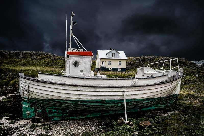
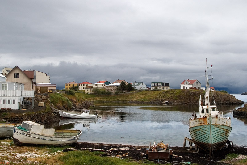
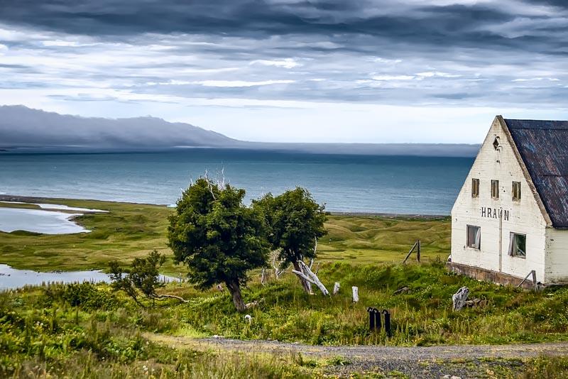
Oggi a Ingjaldsholl non c’è più la nave di Colombo, non c’è più la gigantessa Hetta e non c’è più nemmeno il porto. Un tempo questa era una delle zone più pescose dell’ Islanda, e numerose comunità vivevano di quanto riuscivano a prendere dal mare. Ma nel diciannovesimo secolo le cose iniziarono a cambiare, il mare si fece meno pescoso, le nuove tecniche di pesca permisero di esplorare zone poste più al largo e più pescose, e l’ economia della penisola lentamente decadde, i villaggi si spopolarono, anche le fattorie vennero abbandonate. Snaefellness vive ormai soprattutto di agricoltura e di turismo.
Ti è piaciuto questo racconto fotografico?
Iscriviti alla newsletter per ricevere nuove storie e fotografie di viaggio direttamente nella tua casella di posta.
Ne pubblico una solo quando ho qualcosa di interessante da condividere.
Niente spam, mai.





![Jökulsárlón (literally "glacial river lagoon") is a large glacial lagoon in southeast Iceland, on the borders of Vatnajökull National Park. Situated at the head of Breiðamerkurjökull, it evolved into a lagoon after the glacier started receding from the edge of the Atlantic Ocean. The lake has grown since then at varying rates because of melting of the Icelandic glaciers. The lagoon now stands 1.5 kilometres (0.93 mi) away from the ocean's edge and covers an area of about 18 km2 (6.9 sq mi). It recently became the deepest lake in Iceland at over 248 metres (814 ft) depth as glacial retreat extended its boundaries.[1] The size of the lagoon has increased fourfold since the 1970s.[2][3][4][5] It is considered as one of the natural wonders of Iceland. The lagoon can be seen along Route 1 between Höfn and Skaftafell. It presents a picturesque parade termed as “A ghostly procession of luminous blue ice-bergs through the 17 km2 (6.6 sq mi) (18 km2 (6.9 sq mi) as reported in other sources) Jokulsarlon Lagoon”.[3] Jökulsárlón has been a setting for four Hollywood movies -- A View to a Kill, Die Another Day, Tomb Raider and Batman Begins -- in addition to the reality-TV series Amazing Race.[3][6] A postage stamp depicting Jökulsárlón was issued in 1991 with a face value of 26 krónur.[2] The tongue of the Breiðamerkurjökull glacier is a major attraction for tourists. Tour operators conduct snowmobile and jeep tours to visit the glacier along the winding iceberg-studded Jökulsárlón Lagoon. The base station for visits to the area is at Joklasel, which is approached from Hofn. The Jökulsárlón lagoon provides outstanding views of the Ice Cap, which is a vast dome of ice that rises to a height of 3,000 feet (910 m). It spills to the lagoon 12 miles (19 km) away from the jagged glacier hill to the edge of the water line. The lagoon developed only about 60 years ago (1948 is mentioned), when the entire area was less than 100 feet (30 m) of glacier, which was only 250 yards (230 m) from the Atlantic Ocean, and 2 miles (3.2 km) away from Vatnajökull . Vatnajökull was at the shore line of the ocean and dropped icebergs into the ocean. However, it started drifting in land rapidly every year leaving deep gorges en route, which got filled with melted water and large chunks of ice. These icebergs gather at the mouth of the lagoon’s shallow exit, melt down into smaller ice cubes and roll out into the sea. The lagoon is the lowest point in Iceland with land at 200 metres (660 ft) below sea level. In summer, they melt and roll down the channel into the sea. In winter the lagoon freezes and locks the icebergs in place. Ice water and soil make a unique ecological phenomenon. Jökulsárlón lake or lagoon, the Icelandic “glacier lake” is now reported to have doubled in size in the recent 15-year period. The huge blocks of ice that calve from the edge of Vatnajökull are about 30 metres (98 ft) high which fills the lagoon stocked with icebergs.[5][7][8][9] Some icebergs appear naturally sculpted on account volcanic ashes from ancient eruptions that partly cover them.[10] An iceberg with Vatnajökull in the background. The icebergs in Jökulsárlón, as well as this iceberg, are icebergs that fell off Vatnajökull. An isolated iceberg on the sand beach Glacial lagoon with icebergs With the rate at which Vatnajökull is retreating and the lagoon is getting formed, in the near future, it is anticipated that there is likely to be a deep fjord where Vatnajökull is now. This retreat is also posing a threat to the National Highway Route 1 of Iceland. Reykjavík, the capital of Iceland is 250 kilometres (160 mi) from the lake and the road between the capital and the lagoon winds through a dozen other glaciers, which are also under retreat. It is 75 kilometres (47 mi) to the west of Höfn town and 60 kilometres (37 mi) east of Skaftafell National Park.[8][10] It is accessible by the ring road, Route 1, that goes across the lagoon, and where parking facilities have been provided for visitors. It is also known as the "Tourist Conveyor belt". While walking on the shore, isolated large blocks of icebergs can be seen on the black sand beach.[5] The picturesque scene of the Jökulsárlón lagoon and the Breiðamerkurjökull glacier have been part of the James Bond films A View to a Kill (1985) and Die Another Day (2002), as well as Batman Begins (2005)[3] and Beowulf and Grendel (2005). The popularity of the glaciers could be attributed to these blockbuster films, to Lara Croft's Tomb Raider and also to the popular commercials which have been centred on this location.[4][10] Choreographing the car chase scene, which was once called one of the greatest movie car chases of all time, between a Jaguar and Aston Martin, a set that was created for the film at the location of the lagoon was a challenge to 'Action Unit' Director Vic Armstrong, of the Bond film Die Another Day.[15] The popularity of the lagoon has been further boosted by the TV coverage provided live from Jökulsárlón Lagoon on the American TV program Good Morning America (American morning news and talk show that is broadcast on the ABC television network) in southeast Iceland, on November 13, 2006. The "amazing landscape” covered on the TV programme not only included Jökulsárlón Lagoon filled with icebergs but also pictures of Antarctica and the polar ice caps, which were telecast live from Iceland. This live broadcast, which was made possible by a crew of 30 people, is reported to have been watched by 4 million people. Jökulsárlón è il più grande e più conosciuto lago di origine glaciale dell'Islanda. Situato a sud del ghiacciaio Vatnajökull, tra il Parco nazionale Skaftafell e la città di Höfn, apparve per la prima volta tra il 1934 e il 1935 e dal 1975 crebbe dai 7,9 km² agli attuali 18 km² di superficie, a causa dello scioglimento accelerato dei ghiacciai islandesi. Possiede una profondità massima di circa 200 m, il che lo rende probabilmente il secondo lago più profondo d'Islanda. Una delle sue caratteristiche più sorprendenti è la presenza di numerosi iceberg che derivano dalla lingua del ghiacciaio del Breiðamerkurjökull.](https://www.photosontheroad.eu/wp-content/uploads/2022/03/17072008-IMGP4489.jpg "Jökulsárlón (literally “glacial river lagoon”) is a large glacial lagoon in southeast Iceland, on the borders of Vatnajökull National Park. Situated at the head of Breiðamerkurjökull, it evolved into a lagoon after the glacier started receding from the edge of the Atlantic Ocean. The lake has grown since then at varying rates because of melting of the Icelandic glaciers. The lagoon now stands 1.5 kilometres (0.93 mi) away from the ocean’s edge and covers an area of about 18 km2 (6.9 sq mi). It recently became the deepest lake in Iceland at over 248 metres (814 ft) depth as glacial retreat extended its boundaries.[1] The size of the lagoon has increased fourfold since the 1970s.[2][3][4][5] It is considered as one of the natural wonders of Iceland. The lagoon can be seen along Route 1 between Höfn and Skaftafell. It presents a picturesque parade termed as “A ghostly procession of luminous blue ice-bergs through the 17 km2 (6.6 sq mi) (18 km2 (6.9 sq mi) as reported in other sources) Jokulsarlon Lagoon”.[3] Jökulsárlón has been a setting for four Hollywood movies — A View to a Kill, Die Another Day, Tomb Raider and Batman Begins — in addition to the reality-TV series Amazing Race.[3][6] A postage stamp depicting Jökulsárlón was issued in 1991 with a face value of 26 krónur.[2] The tongue of the Breiðamerkurjökull glacier is a major attraction for tourists. Tour operators conduct snowmobile and jeep tours to visit the glacier along the winding iceberg-studded Jökulsárlón Lagoon. The base station for visits to the area is at Joklasel, which is approached from Hofn. The Jökulsárlón lagoon provides outstanding views of the Ice Cap, which is a vast dome of ice that rises to a height of 3,000 feet (910 m). It spills to the lagoon 12 miles (19 km) away from the jagged glacier hill to the edge of the water line. The lagoon developed only about 60 years ago (1948 is mentioned), when the entire area was less than 100 feet (30 m) of glacier, which was only 250 yards (230 m) from the Atlantic Ocean, and 2 miles (3.2 km) away from Vatnajökull . Vatnajökull was at the shore line of the ocean and dropped icebergs into the ocean. However, it started drifting in land rapidly every year leaving deep gorges en route, which got filled with melted water and large chunks of ice. These icebergs gather at the mouth of the lagoon’s shallow exit, melt down into smaller ice cubes and roll out into the sea. The lagoon is the lowest point in Iceland with land at 200 metres (660 ft) below sea level. In summer, they melt and roll down the channel into the sea. In winter the lagoon freezes and locks the icebergs in place. Ice water and soil make a unique ecological phenomenon. Jökulsárlón lake or lagoon, the Icelandic “glacier lake” is now reported to have doubled in size in the recent 15-year period. The huge blocks of ice that calve from the edge of Vatnajökull are about 30 metres (98 ft) high which fills the lagoon stocked with icebergs.[5][7][8][9] Some icebergs appear naturally sculpted on account volcanic ashes from ancient eruptions that partly cover them.[10] An iceberg with Vatnajökull in the background. The icebergs in Jökulsárlón, as well as this iceberg, are icebergs that fell off Vatnajökull. An isolated iceberg on the sand beach Glacial lagoon with icebergs With the rate at which Vatnajökull is retreating and the lagoon is getting formed, in the near future, it is anticipated that there is likely to be a deep fjord where Vatnajökull is now. This retreat is also posing a threat to the National Highway Route 1 of Iceland. Reykjavík, the capital of Iceland is 250 kilometres (160 mi) from the lake and the road between the capital and the lagoon winds through a dozen other glaciers, which are also under retreat. It is 75 kilometres (47 mi) to the west of Höfn town and 60 kilometres (37 mi) east of Skaftafell National Park.[8][10] It is accessible by the ring road, Route 1, that goes across the lagoon, and where parking facilities have been provided for visitors. It is also known as the “Tourist Conveyor belt”. While walking on the shore, isolated large blocks of icebergs can be seen on the black sand beach.[5] The picturesque scene of the Jökulsárlón lagoon and the Breiðamerkurjökull glacier have been part of the James Bond films A View to a Kill (1985) and Die Another Day (2002), as well as Batman Begins (2005)[3] and Beowulf and Grendel (2005). The popularity of the glaciers could be attributed to these blockbuster films, to Lara Croft’s Tomb Raider and also to the popular commercials which have been centred on this location.[4][10] Choreographing the car chase scene, which was once called one of the greatest movie car chases of all time, between a Jaguar and Aston Martin, a set that was created for the film at the location of the lagoon was a challenge to ‘Action Unit’ Director Vic Armstrong, of the Bond film Die Another Day.[15] The popularity of the lagoon has been further boosted by the TV coverage provided live from Jökulsárlón Lagoon on the American TV program Good Morning America (American morning news and talk show that is broadcast on the ABC television network) in southeast Iceland, on November 13, 2006. The “amazing landscape” covered on the TV programme not only included Jökulsárlón Lagoon filled with icebergs but also pictures of Antarctica and the polar ice caps, which were telecast live from Iceland. This live broadcast, which was made possible by a crew of 30 people, is reported to have been watched by 4 million people. Jökulsárlón è il più grande e più conosciuto lago di origine glaciale dell’Islanda. Situato a sud del ghiacciaio Vatnajökull, tra il Parco nazionale Skaftafell e la città di Höfn, apparve per la prima volta tra il 1934 e il 1935 e dal 1975 crebbe dai 7,9 km² agli attuali 18 km² di superficie, a causa dello scioglimento accelerato dei ghiacciai islandesi. Possiede una profondità massima di circa 200 m, il che lo rende probabilmente il secondo lago più profondo d’Islanda. Una delle sue caratteristiche più sorprendenti è la presenza di numerosi iceberg che derivano dalla lingua del ghiacciaio del Breiðamerkurjökull.")